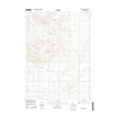
2013 Map of Mammoth Cave
USGS Topo · Published 2013About this map
Mammoth Cave and the surrounding high desert of Lincoln County define this landscape of volcanic geology and hydraulic engineering. The arid terrain is punctuated by the Black Butte Hills and numerous water storage features such as Tom Gooding Lake, Greybull Reservoir, and the Seven Hundred Reservoir. These reservoirs, often named for local geographic draws or figures, speak to the critical importance of water management in southern Idaho's history.
Find a feature on this map
30 named features on this map. Tap any name to fly to it.
Don’t see what you’re looking for? This feature index may not catch every label — zoom into the map to look around manually.
Map Details
Editions of this 2013 Mammoth Cave Map
This is the sole edition of this map. No revisions or reprints were ever made.
Other maps of this area

1955 · Twin Falls
USGS Topo · 1:250,000

1955 · Hailey
USGS Topo · 1:250,000

1957 · Thorn Creek SE
USGS Topo · 1:24,000

1957 · Thorn Creek
USGS Topo · 1:62,500

1958 · Twin Falls
USGS Topo · 1:250,000

1959 · Hailey
USGS Topo · 1:250,000

1962 · Hailey
USGS Topo · 1:250,000

1971 · Dietrich
USGS Topo · 1:24,000

1971 · Tunupa
USGS Topo · 1:24,000
1971 · Shoshone
USGS Topo · 1:24,000