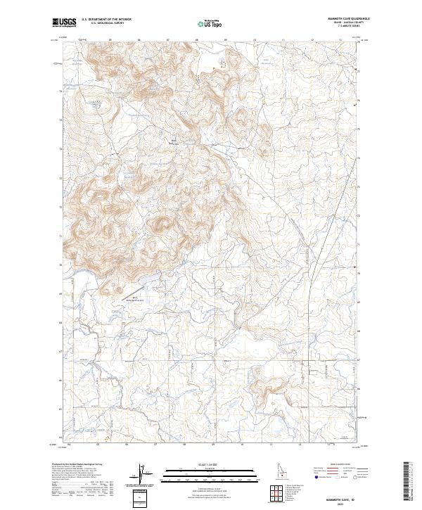
2023 Map of Mammoth Cave
USGS Topo · Published 2023About this map
The Black Butte Hills dominate the high desert terrain of southern Idaho, where an intricate network of irrigation infrastructure transforms the arid landscape. Large-scale water management is the defining characteristic of this region, evidenced by the extensive path of the Milner Gooding Canal and the North Shoshone Canal. These main arteries are supported by numerous numbered laterals, such as Lateral 498A and Lateral 75, which deliver water to the agricultural lands south of the lava fields.
Find a feature on this map
55 named features on this map. Tap any name to fly to it.
Don’t see what you’re looking for? This feature index may not catch every label — zoom into the map to look around manually.
Map Details
Editions of this 2023 Mammoth Cave Map
This is the sole edition of this map. No revisions or reprints were ever made.
Other maps of this area

1955 · Twin Falls
USGS Topo · 1:250,000

1955 · Hailey
USGS Topo · 1:250,000

1957 · Thorn Creek SE
USGS Topo · 1:24,000

1957 · Thorn Creek
USGS Topo · 1:62,500

1958 · Twin Falls
USGS Topo · 1:250,000

1959 · Hailey
USGS Topo · 1:250,000

1962 · Hailey
USGS Topo · 1:250,000

1971 · Dietrich
USGS Topo · 1:24,000

1971 · Tunupa
USGS Topo · 1:24,000
1971 · Shoshone
USGS Topo · 1:24,000