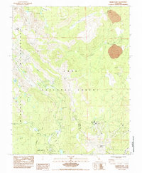
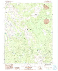
1984 Map of Mammoth Mtn
USGS Topo · Published 1984About this map
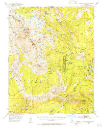
Devils Postpile National Monument and the surrounding Sierra Nevada highlands define this 1984 survey, capturing a landscape deeply shaped by volcanic activity and alpine hydrology. The map details the complex terrain where the Mono and Madera County lines meet, centered on the high ridges of Mammoth Mtn and June Mountain. Notable for its density of outdoor infrastructure, the area includes the famous Devils Postpile formation along the Middle Fork San Joaquin River and the high-altitude Minaret Summit.
Find a feature on this map
51 named features on this map. Tap any name to fly to it.
Don’t see what you’re looking for? This feature index may not catch every label — zoom into the map to look around manually.
Map Details
Editions of this 1984 Mammoth Mtn Map
2 editions found
Other maps of this area

1901 · Mt. Lyell
USGS Topo · 1:125,000

1914 · Mt. Morrison
USGS Topo · 1:125,000

1947 · Mariposa
USGS Topo · 1:250,000

1948 · Mariposa
USGS Topo · 1:250,000
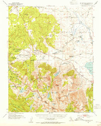
1953 · Mt. Morrison
USGS Topo · 1:62,500
1953 · Mono Craters
USGS Topo · 1:62,500
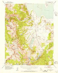
1953 · Devils Postpile
USGS Topo · 1:62,500

1957 · Mariposa
USGS Topo · 1:250,000
1962 · Cowtrack Mtn
USGS Topo · 1:62,500

1963 · Mariposa
USGS Topo · 1:250,000