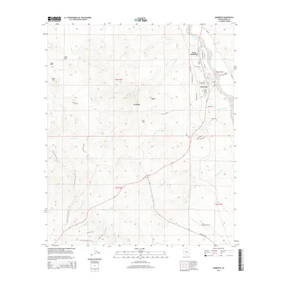
2014 Map of Mammoth
USGS Topo · Published 2014About this map
The high desert landscape of Mammoth and its northern extension, North Mammoth, centers on the intersection of Az-77 and the drainages feeding the San Pedro river valley. The topography is defined by the Black Hills and prominent elevations like Signal Peak and Red Hill, with a network of dry washes including Mammoth Wash, Cottonwood Wash, and Cherry Valley Wash carving through the terrain. Small settlements like Tiger and Fordville are documented alongside local landmarks such as McKinney Cem and the San Manuel Airport in the southeastern corner. Historical and recreational interest is highlighted by the Arizona National Scenic Trail and the Black Hill Ranch RD, illustrating the region's ranching roots and modern land use. The presence of Mammoth Valley View Cem and numerous family-named streets such as Hetzel Ave and Wine Ave provides specific points for genealogical research in this copper-rich corridor.
Find a feature on this map
47 named features on this map. Tap any name to fly to it.
Don’t see what you’re looking for? This feature index may not catch every label — zoom into the map to look around manually.
Map Details
Editions of this 2014 Mammoth Map
This is the sole edition of this map. No revisions or reprints were ever made.
Other maps of this area

1911 · Winkelman
USGS Topo · 1:125,000

1913 · Winkelman
USGS Topo · 1:125,000

1948 · Clark Ranch
USGS Topo · 1:24,000

1948 · Mammoth
USGS Topo · 1:62,500

1948 · Mammoth
USGS Topo · 1:24,000

1948 · Campo Bonito
USGS Topo · 1:24,000

1948 · Peppersauce Wash
USGS Topo · 1:24,000

1949 · Clark Ranch
USGS Topo · 1:24,000

1949 · Mammoth
USGS Topo · 1:24,000

1949 · Campo Bonito
USGS Topo · 1:24,000