
1949 Map of Mammoth
USGS Topo · Published 1949About this map
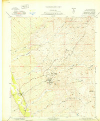
The San Manuel Copper Mine and the community of Tiger anchor this postwar survey of the Pinal County copper corridor. At the time of this 1948 field check, the landscape reveals a complex network of industrial infrastructure supporting the mining district, including a Power House, a Cooling Tower, and a large Tailings Pond north of the main shafts. The rugged Black Hills rise to the west, capped by Signal Peak, while the settlement of Mammoth sits along the western bank of the San Pedro River.
Find a feature on this map
30 named features on this map. Tap any name to fly to it.
Don’t see what you’re looking for? This feature index may not catch every label — zoom into the map to look around manually.
Map Details
Editions of this 1949 Mammoth Map
2 editions found
Other maps of this area

1911 · Winkelman
USGS Topo · 1:125,000

1913 · Winkelman
USGS Topo · 1:125,000

1948 · Clark Ranch
USGS Topo · 1:24,000

1948 · Mammoth
USGS Topo · 1:62,500

1948 · Mammoth
USGS Topo · 1:24,000

1948 · Campo Bonito
USGS Topo · 1:24,000

1948 · Peppersauce Wash
USGS Topo · 1:24,000

1949 · Clark Ranch
USGS Topo · 1:24,000

1949 · Campo Bonito
USGS Topo · 1:24,000
1949 · Peppersauce Wash
USGS Topo · 1:24,000