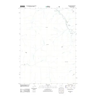
2012 Map of Man Peak
USGS Topo · Published 2012About this map
Man Peak dominates the high elevation terrain of this Lincoln County quadrangle, situated in a landscape defined by sharp drainages and prominent summits. The Greys River carves through the eastern portion of the map, followed closely by the Greys River Rd, which provides access to the Moose Flat Campground at Moose Flat. This corridor represents the primary human footprint in a region otherwise characterized by named peaks such as Visser Peak, Virginia Peak, and Haystack Peak.
Find a feature on this map
21 named features on this map. Tap any name to fly to it.
Don’t see what you’re looking for? This feature index may not catch every label — zoom into the map to look around manually.
Map Details
Editions of this 2012 Man Peak Map
This is the sole edition of this map. No revisions or reprints were ever made.
Other maps of this area

1921 · Afton
USGS Topo · 1:125,000

1931 · Jackson
USGS Topo · 1:125,000

1935 · Jackson
USGS Topo · 1:125,000

1955 · Driggs
USGS Topo · 1:250,000

1955 · Preston
USGS Topo · 1:250,000

1958 · Driggs
USGS Topo · 1:250,000

1958 · Preston
USGS Topo · 1:250,000

1962 · Driggs
USGS Topo · 1:250,000

1962 · Preston
USGS Topo · 1:250,000

1965 · Pickle Pass
USGS Topo · 1:24,000