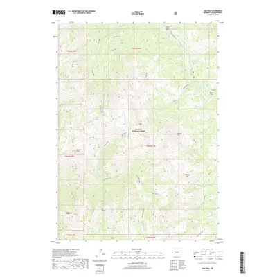
2017 Map of Man Peak
USGS Topo · Published 2017About this map
Man Peak and its neighboring summits dominate this high-altitude landscape within the Bridger National Forest. The 2017 survey reveals a complex drainage system where White Creek and the N Fork Strawberry Cr carve deep paths through the mountainous terrain. The presence of Indian Grave Flat and Moose Flat near the Greys River suggests unique level clearings amidst the otherwise steep topography. A network of routes including the Covey Cutoff and the Way Trail navigate the ridges and canyons, providing access between high points such as Virginia Peak and Sherman Peak. This map details the intricate relationship between the region's geological features like Dry Canyon and Suter Canyon and the established forest trail systems, showing how the land is partitioned by the t34n r117w township markers.
Find a feature on this map
38 named features on this map. Tap any name to fly to it.
Don’t see what you’re looking for? This feature index may not catch every label — zoom into the map to look around manually.
Map Details
Editions of this 2017 Man Peak Map
This is the sole edition of this map. No revisions or reprints were ever made.
Other maps of this area

1921 · Afton
USGS Topo · 1:125,000

1931 · Jackson
USGS Topo · 1:125,000

1935 · Jackson
USGS Topo · 1:125,000

1955 · Driggs
USGS Topo · 1:250,000

1955 · Preston
USGS Topo · 1:250,000

1958 · Driggs
USGS Topo · 1:250,000

1958 · Preston
USGS Topo · 1:250,000

1962 · Driggs
USGS Topo · 1:250,000

1962 · Preston
USGS Topo · 1:250,000

1965 · Pickle Pass
USGS Topo · 1:24,000