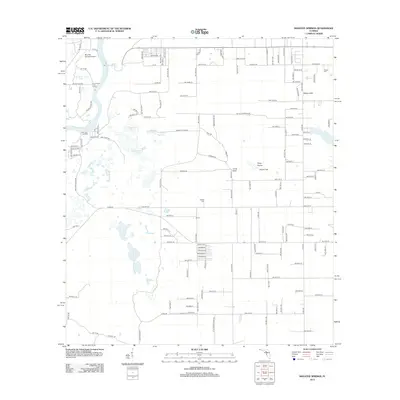
2012 Map of Manatee Springs
USGS Topo · Published 2012About this map
Manatee Springs and the winding Suwannee River anchor this landscape in Levy County, where freshwater springs meet the riverine wetlands of northern Florida. The map reveals a rural geography defined by its karst topography, evidenced by numerous water bodies like Alligator Lake, Willow Sink, and Cook Sink. The settlement pattern is sparse, concentrated at places like Janney and the Sunnyvale Fish Camp near the riverbanks.
Find a feature on this map
134 named features on this map. Tap any name to fly to it.
Don’t see what you’re looking for? This feature index may not catch every label — zoom into the map to look around manually.
Map Details
Editions of this 2012 Manatee Springs Map
This is the sole edition of this map. No revisions or reprints were ever made.
Other maps of this area

1954 · Eugene
USGS Topo · 1:24,000

1954 · Chiefland
USGS Topo · 1:24,000

1954 · Otter Creek
USGS Topo · 1:24,000

1954 · Manatee Springs
USGS Topo · 1:24,000

1954 · Chiefland SW
USGS Topo · 1:24,000

1954 · Vista
USGS Topo · 1:24,000

1954 · East Pass
USGS Topo · 1:24,000

1954 · Gainesville
USGS Topo · 1:250,000

1958 · Gainesville
USGS Topo · 1:250,000

1959 · Gainesville
USGS Topo · 1:250,000