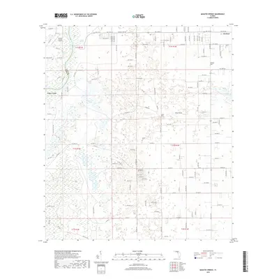
2018 Map of Manatee Springs
USGS Topo · Published 2018About this map
The Suwannee River carves the western boundary of this landscape, separating Dixie and Levy Counties and providing the focal point for the region's natural drainage. At the heart of the riverfront lies Manatee Springs, a significant hydrological feature surrounded by a dense network of local roads and the Manatee Springs Airport. The interior terrain is defined by a karst landscape of ponds and sinks, including Alligator Lake, Sand Pond, and Willow Sink.
Find a feature on this map
138 named features on this map. Tap any name to fly to it.
Don’t see what you’re looking for? This feature index may not catch every label — zoom into the map to look around manually.
Map Details
Editions of this 2018 Manatee Springs Map
This is the sole edition of this map. No revisions or reprints were ever made.
Other maps of this area

1954 · Eugene
USGS Topo · 1:24,000

1954 · Chiefland
USGS Topo · 1:24,000

1954 · Otter Creek
USGS Topo · 1:24,000

1954 · Manatee Springs
USGS Topo · 1:24,000

1954 · Chiefland SW
USGS Topo · 1:24,000

1954 · Vista
USGS Topo · 1:24,000

1954 · East Pass
USGS Topo · 1:24,000

1954 · Gainesville
USGS Topo · 1:250,000

1958 · Gainesville
USGS Topo · 1:250,000

1959 · Gainesville
USGS Topo · 1:250,000