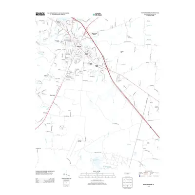
2013 Map of Manchester
USGS Topo · Published 2013About this map
Manchester serves as the focal point of this Coffee County survey, where the Little Duck River and Duck River converge amidst a series of cascades including Bluehole Falls, Big Falls, and Little Falls. The town is surrounded by established residential neighborhoods such as Westwood, Glenview, and White Oaks, while the southern portion of the map is dominated by the sprawling grounds of Arnold Air Force Base.
Find a feature on this map
233 named features on this map. Tap any name to fly to it.
Don’t see what you’re looking for? This feature index may not catch every label — zoom into the map to look around manually.
Map Details
Editions of this 2013 Manchester Map
This is the sole edition of this map. No revisions or reprints were ever made.
Other maps of this area

1893 · Mc Minnville
USGS Topo · 1:125,000

1895 · Mc Minnville
USGS Topo · 1:125,000

1895 · Sewanee
USGS Topo · 1:125,000

1913 · Hollow Springs
USGS Topo · 1:62,500

1936 · Ovoca
USGS Topo · 1:24,000

1936 · Alto
USGS Topo · 1:24,000

1936 · Fredonia
USGS Topo · 1:24,000

1936 · Manchester
USGS Topo · 1:24,000

1936 · Noah
USGS Topo · 1:24,000

1936 · Morrison
USGS Topo · 1:24,000