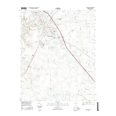
2016 Map of Manchester
USGS Topo · Published 2016About this map
Manchester serves as the central hub of this Coffee County landscape, where the Duck River and its tributaries carve through the geography to create notable landmarks like Big Falls and Little Falls. The area's genealogical history is well-preserved through numerous small burial sites, including Granny Hickerson Cem and Huffar Cem. To the north and west, neighborhoods such as Melrose Park and West Meade define the suburban expansion, while the southern portion of the quadrangle transitions into a more hydrologically complex environment. Here, features like Sinking Pond, Westall Swamp, and the AEDC Retention Reservoir reflect a landscape shaped by both natural drainage and modern water management. Notable crossings such as the Jail Bridge and Powers Bridge mark historic transit points over the river system, anchoring the local road network that branches out toward smaller settlements like Belmont and Black Jack.
Find a feature on this map
161 named features on this map. Tap any name to fly to it.
Don’t see what you’re looking for? This feature index may not catch every label — zoom into the map to look around manually.
Map Details
Editions of this 2016 Manchester Map
This is the sole edition of this map. No revisions or reprints were ever made.
Other maps of this area

1893 · Mc Minnville
USGS Topo · 1:125,000

1895 · Mc Minnville
USGS Topo · 1:125,000

1895 · Sewanee
USGS Topo · 1:125,000

1913 · Hollow Springs
USGS Topo · 1:62,500

1936 · Ovoca
USGS Topo · 1:24,000

1936 · Alto
USGS Topo · 1:24,000

1936 · Fredonia
USGS Topo · 1:24,000

1936 · Manchester
USGS Topo · 1:24,000

1936 · Noah
USGS Topo · 1:24,000

1936 · Morrison
USGS Topo · 1:24,000