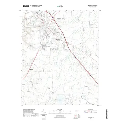
2019 Map of Manchester
USGS Topo · Published 2019About this map
The city of Manchester serves as the focal point for this survey, situated at the confluence of the Little Duck River and several drainage creeks. The landscape is characterized by a mix of residential expansion, such as Melrose Park and Westwood Homes, and significant historical and federal landmarks. To the northwest, the Old Stone Fort stands near Granny Hickerson Cave, highlighting the area's ancient archaeological significance. Further south, the map documents a portion of the Arnold Air Force Base and the AEDC Retention Reservoir, reflecting the modern military presence in Coffee County. The terrain is notably aquatic, featuring numerous wetlands and ponds including Sinking Pond, Cow Pond, and Lemm Swamp, alongside notable natural springs like Goodman Spring. Local genealogy is well-represented through several family-named burial grounds, including Hickerson Cem and Huffar Cem.
Find a feature on this map
167 named features on this map. Tap any name to fly to it.
Don’t see what you’re looking for? This feature index may not catch every label — zoom into the map to look around manually.
Map Details
Editions of this 2019 Manchester Map
This is the sole edition of this map. No revisions or reprints were ever made.
Other maps of this area

1893 · Mc Minnville
USGS Topo · 1:125,000

1895 · Mc Minnville
USGS Topo · 1:125,000

1895 · Sewanee
USGS Topo · 1:125,000

1913 · Hollow Springs
USGS Topo · 1:62,500

1936 · Ovoca
USGS Topo · 1:24,000

1936 · Alto
USGS Topo · 1:24,000

1936 · Fredonia
USGS Topo · 1:24,000

1936 · Manchester
USGS Topo · 1:24,000

1936 · Noah
USGS Topo · 1:24,000

1936 · Morrison
USGS Topo · 1:24,000