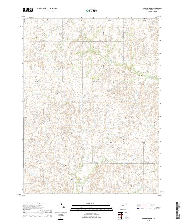
2022 Map of Manchester NW
USGS Topo · Published 2022About this map
Mount Liberty Church Cem serves as a central landmark for this rural landscape in Ottawa County, situated near the northern border along Treaty Rd. This area of Kansas is defined by a dendritic drainage system that feeds into several distinct waterways, including W Chapman Cr, Badger Cr, and Vine Cr. The map reveals a strictly organized grid of agricultural access roads, with names reflecting the local geology and perhaps the aspirations of early settlers, such as Quartz Rd, Nugget Rd, and Limestone Rd. This 2022 survey illustrates the enduring nature of the township and range system, showing the persistent land divisions of t9s r1w and t10s r1w that have governed this prairie terrain for generations.
Find a feature on this map
20 named features on this map. Tap any name to fly to it.
Don’t see what you’re looking for? This feature index may not catch every label — zoom into the map to look around manually.
Map Details
Editions of this 2022 Manchester NW Map
This is the sole edition of this map. No revisions or reprints were ever made.
Other maps of this area

1891 · Clay Center
USGS Topo · 1:125,000

1892 · Minneapolis
USGS Topo · 1:125,000

1955 · Manhattan
USGS Topo · 1:250,000

1956 · Manhattan
USGS Topo · 1:250,000

1957 · Manhattan
USGS Topo · 1:250,000

1964 · Lamar
USGS Topo · 1:24,000

1964 · Idana
USGS Topo · 1:24,000

1964 · Miltonvale
USGS Topo · 1:24,000
1965 · Manchester NW
USGS Topo · 1:24,000
1965 · Vine Creek
USGS Topo · 1:24,000