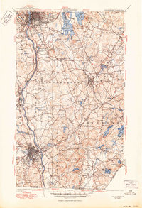
1941 Map of Manchester
USGS Topo · Published 1950About this map
The industrial and residential growth of the Merrimack River valley is documented here, anchored by the urban centers of Manchester and Nashua. The landscape reflects a transition from river-based industry and rail corridors like the B. and M. R. R. to established rural townships including Londonderry and Pelham. Significant local infrastructure is evident, from the Pennichuck Waterworks to the sprawling Pine Grove Cemetery, alongside recreational landmarks like Massabesic Lake and Pine Island Park.
Find a feature on this map
102 named features on this map. Tap any name to fly to it.
Don’t see what you’re looking for? This feature index may not catch every label — zoom into the map to look around manually.
Map Details
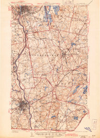
Editions of this 1941 Manchester Map
3 editions found

Other maps of this area

1886 · Lawrence
USGS Topo · 1:62,500

1886 · Lowell
USGS Topo · 1:62,500

1888 · Haverhill
USGS Topo · 1:62,500

1888 · Lawrence
USGS Topo · 1:62,500

1890 · Haverhill
USGS Topo · 1:62,500

1893 · Lowell
USGS Topo · 1:62,500

1893 · Lawrence
USGS Topo · 1:62,500

1893 · Haverhill
USGS Topo · 1:62,500

1893 · Groton
USGS Topo · 1:62,500

1905 · Manchester
USGS Topo · 1:62,500