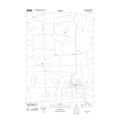
2011 Map of Manchester
USGS Topo · Published 2011About this map
The River Raisin winds through the heart of the landscape, defining the development of Manchester and the surrounding township. This 2011 survey illustrates the agricultural character and legacy of Washtenaw County, where several historic burial grounds like the North Sharon Cemetery and Sharon Township Cemetery remain as anchor points for local genealogy. The small settlement of Sharon Hollow sits along the river's path, while to the north, Sharon Short Hills rises above the glacial terrain. Local infrastructure is marked by a network of rural roads such as Grass Lake Rd and Sharon Hollow Rd, alongside the small Rossettie Airport near Rowes Corner. Water features like Tisch Lake and the Mill Pond fed by Mill Creek illustrate the natural drainage patterns that have supported these communities since their founding.
Find a feature on this map
69 named features on this map. Tap any name to fly to it.
Don’t see what you’re looking for? This feature index may not catch every label — zoom into the map to look around manually.
Map Details
Editions of this 2011 Manchester Map
This is the sole edition of this map. No revisions or reprints were ever made.
Other maps of this area

1902 · Dexter
USGS Topo · 1:62,500

1904 · Ann Arbor
USGS Topo · 1:125,000

1906 · Dexter
USGS Topo · 1:62,500

1906 · Saline
USGS Topo · 1:62,500

1908 · Ann Arbor
USGS Topo · 1:125,000

1919 · Stockbridge
USGS Topo · 1:62,500

1922 · Stockbridge
USGS Topo · 1:62,500

1942 · Stockbridge
USGS Topo · 1:62,500

1948 · Manchester
USGS Topo · 1:62,500

1949 · Manchester
USGS Topo · 1:62,500
Featured Places
- Manchester Township, MI
- Sylvan Township, MI
- Manchester, Manchester Township
- Sharon Township, MI
- Bridgewater Township, MI