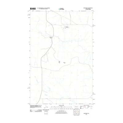
2011 Map of Mandaree
USGS Topo · Published 2011About this map
Mandaree and Spotted Horn define the settled landscape of this western North Dakota quadrangle during the early 21st century. The terrain is characterized by a network of Bureau of Indian Affairs routes, including Bia 12 and Bia 30, which facilitate movement across a high-plains environment marked by significant elevations. Prominent landforms such as Eagle Nest Butte and Phaelens Butte stand as distinct landmarks above the drainage of Moccasin Creek, which winds through the southern portion of the sheet. The spatial arrangement of these features reflects a modern prairie settlement pattern, where roads like Turnkey Ridge Rd and 15th St NW connect remote residences and community centers. This topography is essential for understanding the infrastructure and land use in this part of the state, particularly regarding the relationship between the natural buttes and the established rural road network.
Find a feature on this map
11 named features on this map. Tap any name to fly to it.
Don’t see what you’re looking for? This feature index may not catch every label — zoom into the map to look around manually.
Map Details
Editions of this 2011 Mandaree Map
This is the sole edition of this map. No revisions or reprints were ever made.
Other maps of this area

1953 · Watford City
USGS Topo · 1:250,000

1957 · Watford City
USGS Topo · 1:250,000

1965 · Blue Buttes SE
USGS Topo · 1:24,000

1967 · Watford City
USGS Topo · 1:250,000

1967 · Sanish SE
USGS Topo · 1:24,000

1967 · Sanish SW
USGS Topo · 1:24,000

1970 · Mandaree
USGS Topo · 1:24,000

1970 · Lost Bridge
USGS Topo · 1:24,000

1970 · Figure 4 Ranch
USGS Topo · 1:24,000

1970 · Mandaree SW
USGS Topo · 1:24,000