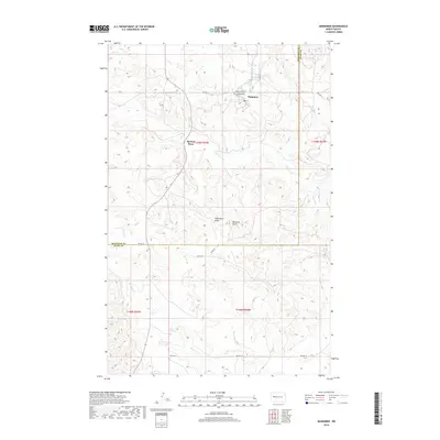
2018 Map of Mandaree
USGS Topo · Published 2018About this map
Mandaree and the nearby settlement of Spotted Horn occupy this dissected plateau landscape on the Fort Berthold Indian Reservation during the late 2010s. The terrain is defined by prominent landmarks such as Eagle Nest Butte and Phaelens Butte, which rise above the drainage systems of Spotted Horn Cr and Moccasin Cr. A network of Bureau of Indian Affairs routes, including BIA Rte 12 and BIA Rte 30, provides the primary infrastructure connecting these upland communities.
Find a feature on this map
19 named features on this map. Tap any name to fly to it.
Don’t see what you’re looking for? This feature index may not catch every label — zoom into the map to look around manually.
Map Details
Editions of this 2018 Mandaree Map
This is the sole edition of this map. No revisions or reprints were ever made.
Other maps of this area

1953 · Watford City
USGS Topo · 1:250,000

1957 · Watford City
USGS Topo · 1:250,000

1965 · Blue Buttes SE
USGS Topo · 1:24,000

1967 · Watford City
USGS Topo · 1:250,000

1967 · Sanish SE
USGS Topo · 1:24,000

1967 · Sanish SW
USGS Topo · 1:24,000

1970 · Mandaree
USGS Topo · 1:24,000

1970 · Lost Bridge
USGS Topo · 1:24,000

1970 · Figure 4 Ranch
USGS Topo · 1:24,000

1970 · Mandaree SW
USGS Topo · 1:24,000