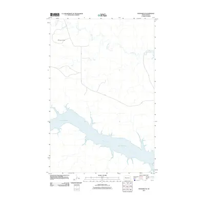
2011 Map of Mandaree SE
USGS Topo · Published 2011About this map
Lake Sakakawea dominates the southern landscape of this 2011 survey, marking the confluence where the Little Missouri River enters the massive reservoir. This topography illustrates the significant modern hydrological changes in the Missouri River basin, as the rising waters fill the coulees and valleys once carved by seasonal flows. To the north, the terrain transitions into the high plains character of the McGregory Buttes, providing a stark elevation contrast to the water-filled lowlands. The drainage of Moccasin Creek winds through the northern sections, while Bia 17 provides the primary infrastructure route through the rugged uplands, reflecting the area's ongoing importance within tribal lands and the larger Missouri Plateau.
Find a feature on this map
5 named features on this map. Tap any name to fly to it.
Don’t see what you’re looking for? This feature index may not catch every label — zoom into the map to look around manually.
Map Details
Editions of this 2011 Mandaree SE Map
This is the sole edition of this map. No revisions or reprints were ever made.
Other maps of this area

1953 · Watford City
USGS Topo · 1:250,000

1957 · Watford City
USGS Topo · 1:250,000

1967 · Watford City
USGS Topo · 1:250,000

1970 · Mandaree
USGS Topo · 1:24,000

1970 · String Buttes
USGS Topo · 1:24,000

1970 · Dunn Center NW
USGS Topo · 1:24,000

1970 · Mandaree SW
USGS Topo · 1:24,000

1970 · Halliday NW
USGS Topo · 1:24,000

1970 · Dunn Center NE
USGS Topo · 1:24,000

1970 · Mandaree SE
USGS Topo · 1:24,000