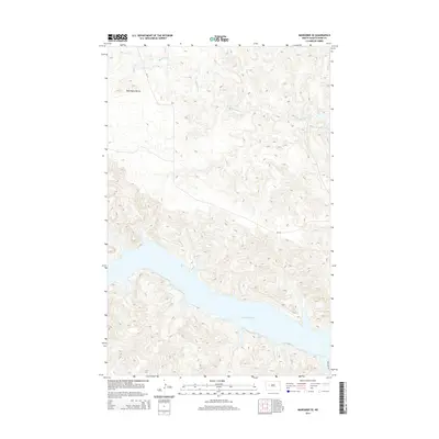
2014 Map of Mandaree SE
USGS Topo · Published 2014About this map
Lake Sakakawea dominates the southern landscape of this Missouri River region, where the water fills the deep valleys of the Fort Berthold Indian Reservation. The terrain is defined by complex drainage patterns feeding into the reservoir, most notably Moccasin Cr which winds through the northern breaks. To the northwest, the prominent rising elevations of the McGregory Buttes provide a distinct topographic landmark above the surrounding draws. The road network is sparse, centered on Bia-17 and 92nd Ave NW, reflecting a landscape primarily shaped by the intersection of high prairie buttes and the expansive shoreline of the lake. This survey documents the shoreline and interior drainage as they appeared in the early 21st century.
Find a feature on this map
5 named features on this map. Tap any name to fly to it.
Don’t see what you’re looking for? This feature index may not catch every label — zoom into the map to look around manually.
Map Details
Editions of this 2014 Mandaree SE Map
This is the sole edition of this map. No revisions or reprints were ever made.
Other maps of this area

1953 · Watford City
USGS Topo · 1:250,000

1957 · Watford City
USGS Topo · 1:250,000

1967 · Watford City
USGS Topo · 1:250,000

1970 · Mandaree
USGS Topo · 1:24,000

1970 · String Buttes
USGS Topo · 1:24,000

1970 · Dunn Center NW
USGS Topo · 1:24,000

1970 · Mandaree SW
USGS Topo · 1:24,000

1970 · Halliday NW
USGS Topo · 1:24,000

1970 · Dunn Center NE
USGS Topo · 1:24,000

1970 · Mandaree SE
USGS Topo · 1:24,000