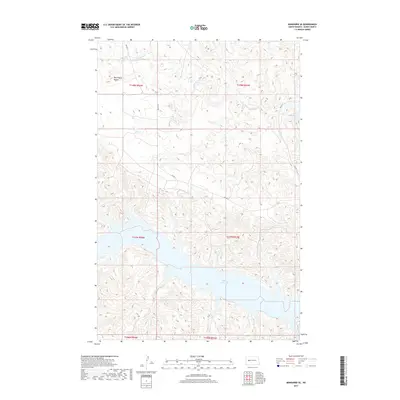
2017 Map of Mandaree SE
USGS Topo · Published 2017About this map
Lake Sakakawea dominates the southern landscape of this Missouri River region, where the reservoir's deeply indented shoreline meets the high plains of Dunn County. The terrain is characterized by the prominent elevation of the McGregory Buttes in the northwest, which rise above the surrounding drainage networks of Moccasin Cr. This 2017 survey reflects the modern infrastructure of the Mandaree area, defined by the grid of Bureau of Indian Affairs routes including Bia Rd 17 and Bia Rd 17 E. The map serves as a detailed record of the public land survey system, clearly delineating the township and range boundaries such as t147n r93w and t148n r94w that organize this part of North Dakota.
Find a feature on this map
11 named features on this map. Tap any name to fly to it.
Don’t see what you’re looking for? This feature index may not catch every label — zoom into the map to look around manually.
Map Details
Editions of this 2017 Mandaree SE Map
This is the sole edition of this map. No revisions or reprints were ever made.
Other maps of this area

1953 · Watford City
USGS Topo · 1:250,000

1957 · Watford City
USGS Topo · 1:250,000

1967 · Watford City
USGS Topo · 1:250,000

1970 · Mandaree
USGS Topo · 1:24,000

1970 · String Buttes
USGS Topo · 1:24,000

1970 · Dunn Center NW
USGS Topo · 1:24,000

1970 · Mandaree SW
USGS Topo · 1:24,000

1970 · Halliday NW
USGS Topo · 1:24,000

1970 · Dunn Center NE
USGS Topo · 1:24,000

1970 · Mandaree SE
USGS Topo · 1:24,000