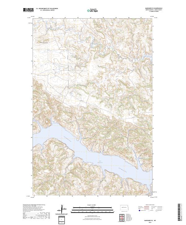
2024 Map of Mandaree SE
USGS Topo · Published 2024About this map
Lake Sakakawea dominates the southern landscape of this Missouri River country, where the flooded valley of the Little Missouri River meets the main reservoir. This contemporary topographic perspective reveals the intricate drainage patterns of the badlands terrain, characterized by the prominent elevation of McGregory Butte in the northwest. The presence of Bia Rd 17 and its various branches, including Bia Rd 17 E and Bia Rd 17 W, indicates the modern transportation network serving the Fort Berthold Indian Reservation area. To the northeast, the headwaters of Moccasin Creek carve through the high prairie, illustrating the transition from upland plateaus to the deeply eroded river breaks that define this portion of Dunn County.
Find a feature on this map
13 named features on this map. Tap any name to fly to it.
Don’t see what you’re looking for? This feature index may not catch every label — zoom into the map to look around manually.
Map Details
Editions of this 2024 Mandaree SE Map
This is the sole edition of this map. No revisions or reprints were ever made.
Other maps of this area

1953 · Watford City
USGS Topo · 1:250,000

1957 · Watford City
USGS Topo · 1:250,000

1967 · Watford City
USGS Topo · 1:250,000

1970 · Mandaree
USGS Topo · 1:24,000

1970 · String Buttes
USGS Topo · 1:24,000

1970 · Dunn Center NW
USGS Topo · 1:24,000

1970 · Mandaree SW
USGS Topo · 1:24,000

1970 · Halliday NW
USGS Topo · 1:24,000

1970 · Dunn Center NE
USGS Topo · 1:24,000

1970 · Mandaree SE
USGS Topo · 1:24,000