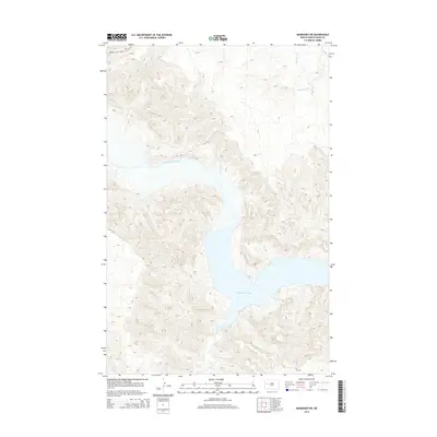
2014 Map of Mandaree SW
USGS Topo · Published 2014About this map
Lake Sakakawea dominates the southern landscape of this 2014 survey, marking the confluence of the Little Missouri River and several secondary drainages. This high-plains terrain is deeply incised by watercourses, with Moccasin Cr and Jim Creek carving through the elevation to reach the reservoir. The topography reflects the dramatic badlands character of North Dakota's western reaches, where the winding river valley met the rising waters of the mid-20th century impoundment. Human infrastructure is concentrated along the western edge, primarily represented by ND-22 and local access routes like 10th St NW. The map reveals the intricate shoreline of the lake as it fingers into various coulees, including Dry Cr, providing a detailed look at the interface between the prairie uplands and the Missouri River system.
Find a feature on this map
10 named features on this map. Tap any name to fly to it.
Don’t see what you’re looking for? This feature index may not catch every label — zoom into the map to look around manually.
Map Details
Editions of this 2014 Mandaree SW Map
This is the sole edition of this map. No revisions or reprints were ever made.
Other maps of this area

1953 · Watford City
USGS Topo · 1:250,000

1957 · Watford City
USGS Topo · 1:250,000

1967 · Watford City
USGS Topo · 1:250,000

1970 · Mandaree
USGS Topo · 1:24,000

1970 · Lost Bridge
USGS Topo · 1:24,000

1970 · Figure 4 Ranch
USGS Topo · 1:24,000

1970 · Dunn Center NW
USGS Topo · 1:24,000

1970 · Mandaree SW
USGS Topo · 1:24,000

1970 · Dunn Center NE
USGS Topo · 1:24,000

1970 · Mandaree SE
USGS Topo · 1:24,000