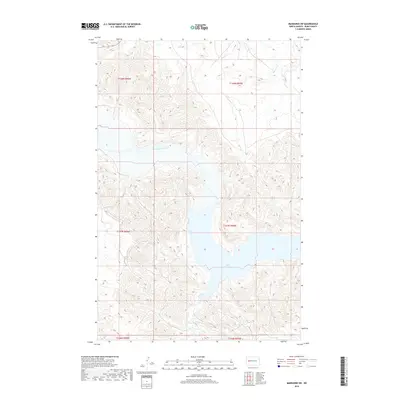
2018 Map of Mandaree SW
USGS Topo · Published 2018About this map
Lake Sakakawea dominates the southeastern portion of this landscape, where its waters meet the rugged drainages of the Missouri Plateau. This 2018 survey illustrates the intricate network of coulees and seasonal streams that feed into the reservoir, including Jim Creek and Dry Cr. Further north, the Little Missouri River snakes through the badlands-style terrain, joined by smaller tributaries like Moccasin Cr. The map provides a high-resolution view of the modern shoreline and the complex topography of Dunn County, highlighting the transition from upland prairie to the deep-cut river valleys and flooded canyons. Local history researchers can trace the precise contours of the land across townships like t147n r94w, offering a clear picture of the area's hydrology and land divisions in the early 21st century.
Find a feature on this map
12 named features on this map. Tap any name to fly to it.
Don’t see what you’re looking for? This feature index may not catch every label — zoom into the map to look around manually.
Map Details
Editions of this 2018 Mandaree SW Map
This is the sole edition of this map. No revisions or reprints were ever made.
Other maps of this area

1953 · Watford City
USGS Topo · 1:250,000

1957 · Watford City
USGS Topo · 1:250,000

1967 · Watford City
USGS Topo · 1:250,000

1970 · Mandaree
USGS Topo · 1:24,000

1970 · Lost Bridge
USGS Topo · 1:24,000

1970 · Figure 4 Ranch
USGS Topo · 1:24,000

1970 · Dunn Center NW
USGS Topo · 1:24,000

1970 · Mandaree SW
USGS Topo · 1:24,000

1970 · Dunn Center NE
USGS Topo · 1:24,000

1970 · Mandaree SE
USGS Topo · 1:24,000