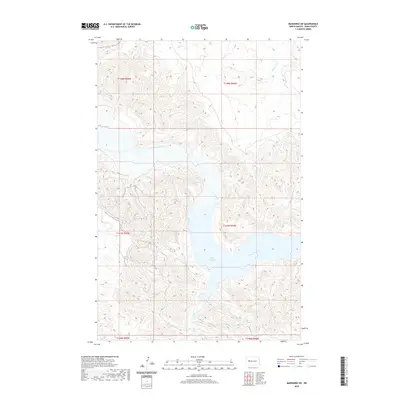
2020 Map of Mandaree SW
USGS Topo · Published 2020About this map
Lake Sakakawea dominates the center of this landscape, marking the confluence where the Missouri River meets its western tributary. The terrain is defined by the complex drainage systems of the North Dakota badlands, where the Little Missouri River flows through deep-cut valleys in the northern portion of the quadrangle. Smaller waterways like Moccasin Cr and the winding course of Jim Creek (also labeled as Jim Cr) carve through the high plateaus of Dunn County. This 2020 map documents the modern shoreline of the reservoir, revealing how the managed waters of the Missouri basin interact with the traditional township and range survey lines. The interplay of high relief and wide water bodies illustrates the distinct geographical character of the Mandaree region, balancing vast riparian environments with the stark, tiered topography of the surrounding plains.
Find a feature on this map
12 named features on this map. Tap any name to fly to it.
Don’t see what you’re looking for? This feature index may not catch every label — zoom into the map to look around manually.
Map Details
Editions of this 2020 Mandaree SW Map
This is the sole edition of this map. No revisions or reprints were ever made.
Other maps of this area

1953 · Watford City
USGS Topo · 1:250,000

1957 · Watford City
USGS Topo · 1:250,000

1967 · Watford City
USGS Topo · 1:250,000

1970 · Mandaree
USGS Topo · 1:24,000

1970 · Lost Bridge
USGS Topo · 1:24,000

1970 · Figure 4 Ranch
USGS Topo · 1:24,000

1970 · Dunn Center NW
USGS Topo · 1:24,000

1970 · Mandaree SW
USGS Topo · 1:24,000

1970 · Dunn Center NE
USGS Topo · 1:24,000

1970 · Mandaree SE
USGS Topo · 1:24,000