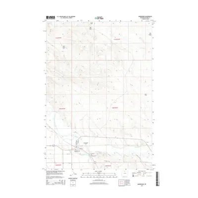
2015 Map of Manderson
USGS Topo · Published 2015About this map
The Bighorn River and Nowood River converge in this Big Horn County landscape, anchoring the town of Manderson. The settlement is closely tied to its agricultural environment, evidenced by the extensive irrigation network including Harmony Ditch and Avent Ditch that weave through the valley. This 2015 data illustrates a complex system of county roads and lanes, such as Ainsworth Units Rd and N Sherman Ave, which connect local residents to key landmarks like Schoolhouse Gulch and the Manderson Cem.
Find a feature on this map
31 named features on this map. Tap any name to fly to it.
Don’t see what you’re looking for? This feature index may not catch every label — zoom into the map to look around manually.
Map Details
Editions of this 2015 Manderson Map
This is the sole edition of this map. No revisions or reprints were ever made.
Other maps of this area

1951 · Schuster Flats NE
USGS Topo · 1:24,000

1955 · Cody
USGS Topo · 1:250,000

1955 · Sheridan
USGS Topo · 1:250,000

1958 · Cody
USGS Topo · 1:250,000

1958 · Sheridan
USGS Topo · 1:250,000

1960 · Manderson
USGS Topo · 1:24,000

1960 · Manderson NE
USGS Topo · 1:24,000

1960 · Manderson SE
USGS Topo · 1:24,000

1960 · Wild Horse Flats
USGS Topo · 1:24,000

1962 · Sheridan
USGS Topo · 1:250,000