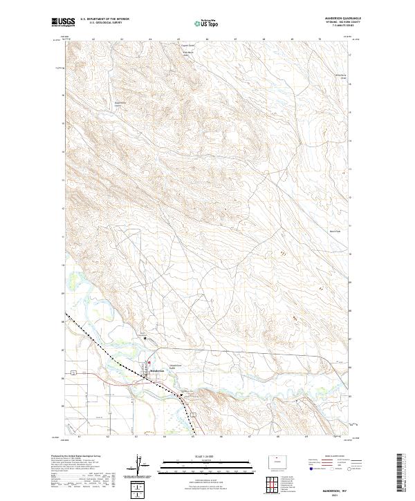
2021 Map of Manderson
USGS Topo · Published 2021About this map
The town of Manderson sits at the significant confluence of the Bighorn River and the Nowood River, serving as a focal point for this Big Horn County landscape. The mapping reveals an intricate network of irrigation vital to the region's agricultural character, including the prominent Big Horn Canal, Harmony Ditch, and Avent Ditch. These waterways carve through the terrain, supporting the lowlands near Basin Flats while the surrounding geography is defined by numerous seasonal drainages such as Schoolhouse Gulch, Dead Horse Gulch, and Coyote Gulch. For those researching local family histories, the map identifies specific burial sites including the Manderson Cemetery and the more secluded Smith Family Cemetery. The layout of the town itself is detailed along North Sherman Avenue and Center Street, illustrating the settlement's orientation relative to the vital river systems and the western high plains topography.
Find a feature on this map
30 named features on this map. Tap any name to fly to it.
Don’t see what you’re looking for? This feature index may not catch every label — zoom into the map to look around manually.
Map Details
Editions of this 2021 Manderson Map
This is the sole edition of this map. No revisions or reprints were ever made.
Other maps of this area

1951 · Schuster Flats NE
USGS Topo · 1:24,000

1955 · Cody
USGS Topo · 1:250,000

1955 · Sheridan
USGS Topo · 1:250,000

1958 · Cody
USGS Topo · 1:250,000

1958 · Sheridan
USGS Topo · 1:250,000

1960 · Manderson
USGS Topo · 1:24,000

1960 · Manderson NE
USGS Topo · 1:24,000

1960 · Manderson SE
USGS Topo · 1:24,000

1960 · Wild Horse Flats
USGS Topo · 1:24,000

1962 · Sheridan
USGS Topo · 1:250,000