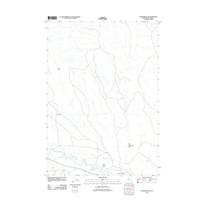
2012 Map of Manderson SE
USGS Topo · Published 2012About this map
The Nowood River meanders across this Big Horn County landscape, supporting a network of irrigation works essential to high-desert agriculture. Water from the river is diverted into the Avent Ditch and Shafer Ditch, engineering that defines the land use patterns south of Basin Flats. This 2012 survey illustrates the topographical complexity of the region, where the Alkali Cr. drainage system and numerous draws like Wild Horse Draw cut through the arid terrain. The map captures the intersection of natural watercourses and human-made infrastructure, most notably where Lane 50 crosses the river valley near McDermotts Gulch.
Find a feature on this map
10 named features on this map. Tap any name to fly to it.
Don’t see what you’re looking for? This feature index may not catch every label — zoom into the map to look around manually.
Map Details
Editions of this 2012 Manderson SE Map
This is the sole edition of this map. No revisions or reprints were ever made.
Other maps of this area

1955 · Sheridan
USGS Topo · 1:250,000

1958 · Sheridan
USGS Topo · 1:250,000

1960 · White Sulphur Spring
USGS Topo · 1:24,000

1960 · Manderson
USGS Topo · 1:24,000

1960 · Flitner Reservoir
USGS Topo · 1:24,000

1960 · Manderson NE
USGS Topo · 1:24,000

1960 · Manderson SE
USGS Topo · 1:24,000

1960 · Wild Horse Flats
USGS Topo · 1:24,000

1962 · Sheridan
USGS Topo · 1:250,000
1967 · Weintz Draw
USGS Topo · 1:24,000