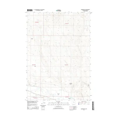
2015 Map of Manderson SE
USGS Topo · Published 2015About this map
The Nowood River meanders through the southern reaches of this Big Horn County landscape, supporting an agricultural infrastructure defined by the Shafer Ditch and Avent Ditch. This network of irrigation channels contrasts with the arid uplands of Basin Flats and the dissected terrain of the northern sections. Topographical landmarks such as Blue Ridge and Coyote Gulch provide distinct reference points for understanding the drainage patterns of Alkali Cr. The map details the transition from high-desert flats to the more varied relief of McDermotts Gulch and Wild Horse Draw. Local transit is anchored by rural routes including CR 50 and Lane 50, which trace the low-lying areas near the river valley, offering a precise look at land divisions and water management in this Wyoming interior.
Find a feature on this map
19 named features on this map. Tap any name to fly to it.
Don’t see what you’re looking for? This feature index may not catch every label — zoom into the map to look around manually.
Map Details
Editions of this 2015 Manderson SE Map
This is the sole edition of this map. No revisions or reprints were ever made.
Other maps of this area

1955 · Sheridan
USGS Topo · 1:250,000

1958 · Sheridan
USGS Topo · 1:250,000

1960 · White Sulphur Spring
USGS Topo · 1:24,000

1960 · Manderson
USGS Topo · 1:24,000

1960 · Flitner Reservoir
USGS Topo · 1:24,000

1960 · Manderson NE
USGS Topo · 1:24,000

1960 · Manderson SE
USGS Topo · 1:24,000

1960 · Wild Horse Flats
USGS Topo · 1:24,000

1962 · Sheridan
USGS Topo · 1:250,000
1967 · Weintz Draw
USGS Topo · 1:24,000