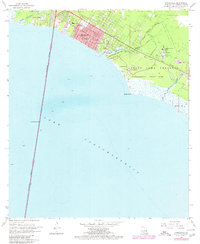
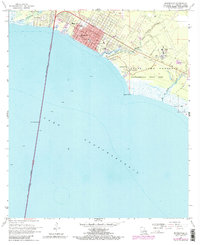
1968 Map of Mandeville
USGS Topo · Published 1980About this map
Mandeville and Lewisburg anchor the northern shore of Lake Pontchartrain, showing a period of significant growth and conservation on the St. Tammany Parish coast. The map illustrates the town's educational infrastructure through Mandeville School, the High School, and the Rosenwald School, alongside religious landmarks such as Our Lady of the Lake School.
Find a feature on this map
25 named features on this map. Tap any name to fly to it.
Don’t see what you’re looking for? This feature index may not catch every label — zoom into the map to look around manually.
Map Details
Editions of this 1968 Mandeville Map
5 editions found
Other maps of this area

1891 · Spanish Fort
USGS Topo · 1:62,500

1892 · Chef Menteur
USGS Topo · 1:62,500

1935 · Slidell
USGS Topo · 1:62,500

1935 · Covington
USGS Topo · 1:62,500

1936 · South Point
USGS Topo · 1:31,680

1936 · Chef Menteur
USGS Topo · 1:62,500

1936 · Spanish Fort
USGS Topo · 1:62,500

1939 · Slidell
USGS Topo · 1:62,500

1939 · Covington
USGS Topo · 1:62,500

1950 · Slidell
USGS Topo · 1:62,500