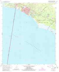
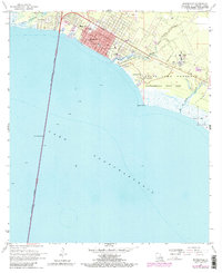
1968 Map of Mandeville
USGS Topo · Published 1984About this map
Mandeville and the neighboring settlement of Lewisburg define this north shore reach of Lake Pontchartrain during a period of significant growth. The map illustrates a landscape transitioning from the manicured grounds of Fontainebleau State Park and the State Game Preserve to the expanding municipal infrastructure of the mid-to-late 20th century. Key local landmarks include the Mandeville School, the Southeast Louisiana Hospital campus, and the prominent Lake Pontchartrain Causeway, which anchors the western edge of the shoreline.
Find a feature on this map
28 named features on this map. Tap any name to fly to it.
Don’t see what you’re looking for? This feature index may not catch every label — zoom into the map to look around manually.
Map Details
Editions of this 1968 Mandeville Map
5 editions found
Other maps of this area

1891 · Spanish Fort
USGS Topo · 1:62,500

1892 · Chef Menteur
USGS Topo · 1:62,500

1935 · Slidell
USGS Topo · 1:62,500

1935 · Covington
USGS Topo · 1:62,500

1936 · South Point
USGS Topo · 1:31,680

1936 · Chef Menteur
USGS Topo · 1:62,500

1936 · Spanish Fort
USGS Topo · 1:62,500

1939 · Slidell
USGS Topo · 1:62,500

1939 · Covington
USGS Topo · 1:62,500

1950 · Slidell
USGS Topo · 1:62,500