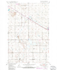
1950 Map of Manfred
USGS Topo · Published 1986About this map
The James River snakes through this portion of Wells County, shaping a landscape defined by prairie agriculture and seasonal wetlands. The small settlement of Manfred serves as the primary rail hub, situated along the Soo Line tracks that cut diagonally across the northern townships. This 1950s-era survey, later photorevised in the 1980s, captures the rural educational infrastructure of the mid-century with Eigenheim School No 1 and Eigenheim School No 5 positioned to serve the outlying farmsteads of Rusland and Manfred townships.
Find a feature on this map
16 named features on this map. Tap any name to fly to it.
Don’t see what you’re looking for? This feature index may not catch every label — zoom into the map to look around manually.
Map Details
Editions of this 1950 Manfred Map
2 editions found

Other maps of this area

1941 · Selz
USGS Topo · 1:62,500

1943 · Maddock
USGS Topo · 1:62,500

1945 · Maddock
USGS Topo · 1:62,500

1945 · Manfred
USGS Topo · 1:62,500

1948 · Fessenden
USGS Topo · 1:62,500

1948 · Manfred
USGS Topo · 1:62,500

1949 · Fessenden SW
USGS Topo · 1:24,000

1949 · Fessenden West
USGS Topo · 1:24,000

1949 · Manfred SW
USGS Topo · 1:24,000

1950 · Manfred SE
USGS Topo · 1:24,000