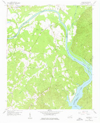
1956 Map of Mangum
USGS Topo · Published 1976About this map
The Pee Dee River and the Little River converge in this mid-century landscape, defining the boundary between Anson and Richmond Counties. This survey captures a rural network of river-oriented infrastructure, most notably the locations of the Old Stanback Ferry and Old Smith Ferry, along with the Old Ferry Road that connected these vital crossings. The southeastern corner is dominated by the waters of Blewett Falls Lake, where the Grassy Islands and Naked Cr break the shoreline near Petty Gulf.
Find a feature on this map
41 named features on this map. Tap any name to fly to it.
Don’t see what you’re looking for? This feature index may not catch every label — zoom into the map to look around manually.
Map Details
Editions of this 1956 Mangum Map

Other maps of this area

1941 · Spartanburg
USGS Topo · 1:250,000

1942 · Troy
USGS Topo · 1:125,000

1942 · Rockingham
USGS Topo · 1:125,000

1953 · Florence
USGS Topo · 1:250,000

1953 · Raleigh
USGS Topo · 1:250,000

1953 · Spartanburg
USGS Topo · 1:250,000

1953 · Charlotte
USGS Topo · 1:250,000

1954 · Charlotte
USGS Topo · 1:250,000

1954 · Florence
USGS Topo · 1:250,000

1954 · Raleigh
USGS Topo · 1:250,000