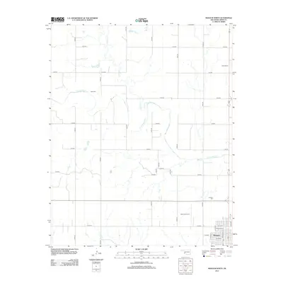
2012 Map of Mangum North
USGS Topo · Published 2012About this map
Mangum occupies the southeastern corner of this Greer County landscape, showing the city's residential street grid including Washington St and N Oklahoma Ave. The terrain is defined by the winding course of the Elm Fork Red River, which meanders across the central and western sections of the map, joined by tributaries such as Haystack Cr and Fish Cr. These watercourses create a complex drainage pattern that contrasts with the rigid section-line road system, including N1900 Rd and E1450 Rd. Local history is anchored by the Marie Cem and Roselawn Cem, while aviation activity is represented by Scott Airport and Scott Field Airport. The map documents the northern expansion of the county seat as it stood in the early 21st century.
Find a feature on this map
32 named features on this map. Tap any name to fly to it.
Don’t see what you’re looking for? This feature index may not catch every label — zoom into the map to look around manually.
Map Details
Editions of this 2012 Mangum North Map
This is the sole edition of this map. No revisions or reprints were ever made.
Other maps of this area

1955 · Lawton
USGS Topo · 1:250,000

1955 · Clinton
USGS Topo · 1:250,000

1957 · Clinton
USGS Topo · 1:250,000

1961 · Willow
USGS Topo · 1:62,500

1961 · Retrop
USGS Topo · 1:62,500

1971 · Russell
USGS Topo · 1:24,000

1971 · Mangum North
USGS Topo · 1:24,000

1971 · Granite
USGS Topo · 1:24,000

1971 · Mangum South
USGS Topo · 1:24,000

1971 · Hester
USGS Topo · 1:24,000