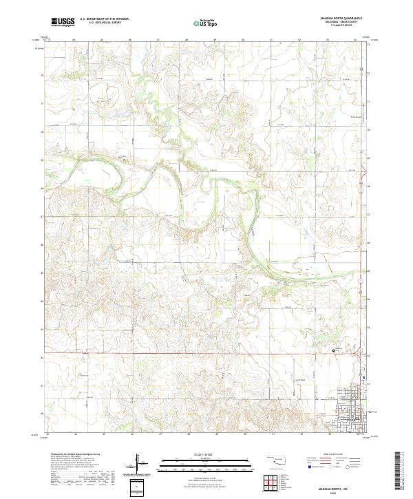
2022 Map of Mangum North
USGS Topo · Published 2022About this map
The city of Mangum serves as the focal point for this western Oklahoma landscape, situated at the southern edge of the survey area. The town’s residential and civic layout is visible along streets such as N Louis Tittle Ave and W Wilson St, showcasing the community's established grid. Rural life north of town is defined by a systematic network of section-line roads, including E1400 Rd and N1900 Rd, which provide access to family burial grounds like Marie Cem and Roselawn Cem.
Find a feature on this map
34 named features on this map. Tap any name to fly to it.
Don’t see what you’re looking for? This feature index may not catch every label — zoom into the map to look around manually.
Map Details
Editions of this 2022 Mangum North Map
This is the sole edition of this map. No revisions or reprints were ever made.
Other maps of this area

1955 · Lawton
USGS Topo · 1:250,000

1955 · Clinton
USGS Topo · 1:250,000

1957 · Clinton
USGS Topo · 1:250,000

1961 · Willow
USGS Topo · 1:62,500

1961 · Retrop
USGS Topo · 1:62,500

1971 · Russell
USGS Topo · 1:24,000

1971 · Mangum North
USGS Topo · 1:24,000

1971 · Granite
USGS Topo · 1:24,000

1971 · Mangum South
USGS Topo · 1:24,000

1971 · Hester
USGS Topo · 1:24,000