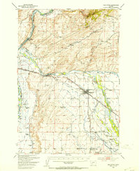
1949 Map of Manhattan
USGS Topo · Published 1953About this map
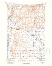
The Gallatin River and Missouri River converge in this mid-century portrait of Montana's agricultural heartland. The landscape is defined by an intricate network of irrigation, featuring works like the Lowline Canal, Moreland Ditch, and Sloan Ditch, which support numerous family-named properties such as the Jorgenson Ranch and Mc Donnell Ranch. Settlement patterns follow the competing steel of the Chicago Milwaukee St Paul and Pacific and Northern Pacific railroads, which bisect the valley floor.
Find a feature on this map
56 named features on this map. Tap any name to fly to it.
Don’t see what you’re looking for? This feature index may not catch every label — zoom into the map to look around manually.
Map Details
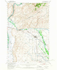
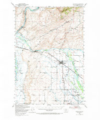
Editions of this 1949 Manhattan Map
4 editions found
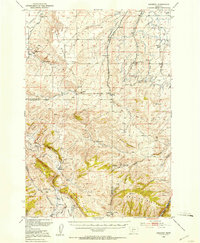
Other maps of this area

1886 · Fort Logan
USGS Topo · 1:250,000

1888 · Three Forks
USGS Topo · 1:250,000

1894 · Three Forks
USGS Topo · 1:250,000

1895 · Three Forks
USGS Topo · 1:250,000

1947 · Bozeman
USGS Topo · 1:250,000

1948 · Bozeman
USGS Topo · 1:250,000

1948 · White Sulphur Springs
USGS Topo · 1:250,000

1949 · Radersburg
USGS Topo · 1:62,500
1949 · Anceney
USGS Topo · 1:62,500
1949 · Manhattan
USGS Topo · 1:62,500