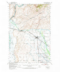
1949 Map of Manhattan
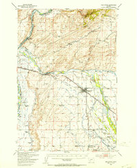
USGS Topo · Published 1972About this map
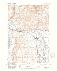
The confluence of three major rivers—the Missouri River, Gallatin River, and Madison River—defines this mid-century landscape in the Gallatin Valley. The rail network of the Chicago Milwaukee St Paul and Pacific and Northern Pacific railroads dictates the placement of settlements like Logan and Manhattan, while an extensive system of irrigation, including the Lowline Canal and White Valley Ditch, underscores the importance of valley agriculture. To the north, the Horseshoe Hills rise above the river plains, marked by canyons such as Nixon Gulch. Family-named operations and local landmarks like the Climbing Arrow Ranch, Sinnema Windmill Ranch, and the Abandoned Mine in the hills provide deep detail for researchers looking into the region's ranching and early mining roots before modern development reached these rural areas.
Find a feature on this map
61 named features on this map. Tap any name to fly to it.
Don’t see what you’re looking for? This feature index may not catch every label — zoom into the map to look around manually.
Map Details
Editions of this 1949 Manhattan Map
4 editions found
Other maps of this area

1886 · Fort Logan
USGS Topo · 1:250,000

1888 · Three Forks
USGS Topo · 1:250,000

1894 · Three Forks
USGS Topo · 1:250,000

1895 · Three Forks
USGS Topo · 1:250,000

1947 · Bozeman
USGS Topo · 1:250,000

1948 · Bozeman
USGS Topo · 1:250,000

1948 · White Sulphur Springs
USGS Topo · 1:250,000

1949 · Radersburg
USGS Topo · 1:62,500
1949 · Anceney
USGS Topo · 1:62,500
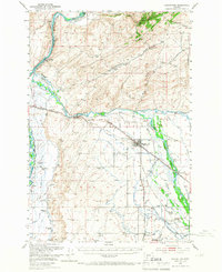
1949 · Manhattan
USGS Topo · 1:62,500