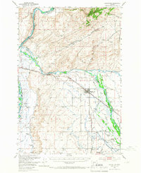
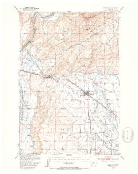
1949 Map of Manhattan
USGS Topo · Published 1966About this map
The Missouri River forms at the confluence of the Madison River and Gallatin River, a landscape-defining intersection mapped here just after the war. This survey highlights an intricate network of early irrigation infrastructure, featuring the Lowline Canal, Moreland Canal, and Lewis and Clark Canal that turned the valley into a productive agricultural hub. Settlement patterns are closely tied to the water and the competing rail lines of the Chicago Milwaukee St Paul and Pacific and the Northern Pacific.
Find a feature on this map
60 named features on this map. Tap any name to fly to it.
Don’t see what you’re looking for? This feature index may not catch every label — zoom into the map to look around manually.
Map Details
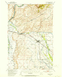
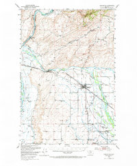
Editions of this 1949 Manhattan Map
4 editions found
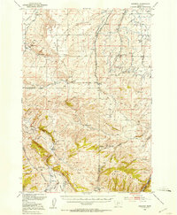
Other maps of this area

1886 · Fort Logan
USGS Topo · 1:250,000

1888 · Three Forks
USGS Topo · 1:250,000

1894 · Three Forks
USGS Topo · 1:250,000

1895 · Three Forks
USGS Topo · 1:250,000

1947 · Bozeman
USGS Topo · 1:250,000

1948 · Bozeman
USGS Topo · 1:250,000

1948 · White Sulphur Springs
USGS Topo · 1:250,000

1949 · Radersburg
USGS Topo · 1:62,500
1949 · Anceney
USGS Topo · 1:62,500
1949 · Manhattan
USGS Topo · 1:62,500