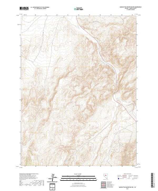
2021 Map of Manhattan Mountain NW
USGS Topo · Published 2021About this map
Reese River winds through this arid stretch of Lander County, carving a narrow valley through high-desert terrain. In an environment defined by extreme relief and elevation, localized water sources like Willow Creek Spring become critical landmarks for surveyors and travelers alike. The landscape is structured by the Public Land Survey System, with grid lines for t24n r42e and t25n r43e marking the transition between open basins and the rising flanks of nearby peaks. Apart from the intermittent flow of the river and the reach of Carico Lake Valley Rd, the area remains largely undeveloped, showcasing the raw topography of the Great Basin as it appeared in the early 21st century.
Find a feature on this map
9 named features on this map. Tap any name to fly to it.
Don’t see what you’re looking for? This feature index may not catch every label — zoom into the map to look around manually.
Map Details
Editions of this 2021 Manhattan Mountain NW Map
This is the sole edition of this map. No revisions or reprints were ever made.
Other maps of this area

1932 · Sonoma Range
USGS Topo · 1:250,000

1939 · Sonoma Range
USGS Topo · 1:250,000

1955 · Millett
USGS Topo · 1:250,000

1955 · Winnemucca
USGS Topo · 1:250,000

1958 · Winnemucca
USGS Topo · 1:250,000

1959 · Millett
USGS Topo · 1:250,000

1961 · The Cedars
USGS Topo · 1:62,500

1961 · Mt. Moses
USGS Topo · 1:62,500

1962 · Winnemucca
USGS Topo · 1:250,000

1969 · Manhattan Mtn
USGS Topo · 1:24,000