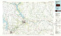
1985 Map of Manhattan
USGS Topo · Published 1986About this map
Manhattan serves as the focal point of this 1980s landscape, situated at the confluence of the Kansas River and the Blue River. The region is defined by significant federal and educational land use, including the expansive Fort Riley Military Reservation to the southwest and the Konza Prairie Natural Area managed by Kansas State University. The Union Pacific railroad corridor tracks the northern bank of the Kansas River, connecting river towns such as Wamego and St Marys. Large-scale water management projects dominate the local geography, notably the massive Tuttle Creek Lake and Milford Lake, which have reshaped the drainage patterns of the Blue Valley. Researchers will find a mix of established university-linked urban growth and traditional agricultural townships, alongside military installations like Camp Whitside and Camp Funston.
Find a feature on this map
123 named features on this map. Tap any name to fly to it.
Don’t see what you’re looking for? This feature index may not catch every label — zoom into the map to look around manually.
Map Details
Editions of this 1985 Manhattan Map
This is the sole edition of this map. No revisions or reprints were ever made.
Other maps of this area

1885 · Eskridge
USGS Topo · 1:125,000

1886 · Junction City
USGS Topo · 1:125,000

1888 · Hiawatha
USGS Topo · 1:125,000

1889 · Burlingame
USGS Topo · 1:125,000

1889 · Seneca
USGS Topo · 1:125,000

1889 · Wamego
USGS Topo · 1:125,000

1889 · Marysville
USGS Topo · 1:125,000

1889 · Junction City
USGS Topo · 1:125,000

1889 · Abilene
USGS Topo · 1:125,000

1889 · Parkerville
USGS Topo · 1:125,000