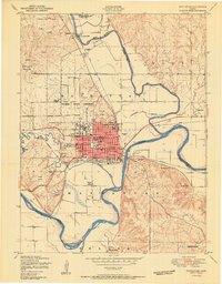
1950 Map of Manhattan
USGS Topo · Published 1950About this map
Kansas State College and the surrounding neighborhoods of Manhattan define this 1950 portrait of the confluence where the Big Blue River meets the Kansas River. The urban core is detailed with civic landmarks like Memorial Stadium, the Post office, and City hall, while the outskirts reveal a landscape of rural education with numerous small institutions including Blue Valley School, Oak Grove School, and Sunnyside School. Industrial and infrastructure elements are prominent, from the Kansas Power and Light Plant near Rockford to the intersecting tracks of the Union Pacific and the Chicago Rock Island and Pacific railroads. The topography shifts from the river flats to the elevated terrain of Fremont Point, illustrating the geographic constraints that shaped the town's early mid-century expansion.
Find a feature on this map
43 named features on this map. Tap any name to fly to it.
Don’t see what you’re looking for? This feature index may not catch every label — zoom into the map to look around manually.
Map Details
Editions of this 1950 Manhattan Map
2 editions found
Other maps of this area

1886 · Junction City
USGS Topo · 1:125,000

1889 · Wamego
USGS Topo · 1:125,000

1889 · Junction City
USGS Topo · 1:125,000

1894 · Junction City
USGS Topo · 1:125,000

1894 · Wamego
USGS Topo · 1:125,000

1947 · Manhattan
USGS Topo · 1:62,500

1950 · Keats
USGS Topo · 1:24,000

1950 · Manhattan
USGS Topo · 1:24,000

1951 · Swede Creek
USGS Topo · 1:24,000

1951 · Ogden
USGS Topo · 1:24,000