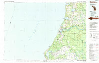
1983 Map of Manistee
USGS Topo · Published 1983About this map
The Manistee River and Little Manistee River converge into Manistee Lake before reaching the Lake Michigan shoreline, defining the industrial and maritime layout of this region in the early 1980s. The shoreline is punctuated by prominent landmarks such as Big Sable Point and North Point, while the interior landscape is dominated by the sprawling Manistee National Forest and Pere Marquette State Forest. Smaller settlements like Kaleva, Brethren, and Freesoil are linked by the Chesapeake and Ohio railroad corridor, reflecting a timber and transit-based economy. To the north, Portage Lake and Arcadia Lake provide natural harbors for coastal communities like Onekama and Arcadia. Traces of the region's deeper history remain visible through the Old Indian Trail and the placement of rural junctions such as Star Corners and Onekama Junction.
Find a feature on this map
80 named features on this map. Tap any name to fly to it.
Don’t see what you’re looking for? This feature index may not catch every label — zoom into the map to look around manually.
Map Details
Editions of this 1983 Manistee Map
This is the sole edition of this map. No revisions or reprints were ever made.
Other maps of this area

1931 · Custer NW
USGS Topo · 1:31,680

1931 · Baldwin NW
USGS Topo · 1:31,680

1931 · Custer NE
USGS Topo · 1:31,680

1931 · Manistee SE
USGS Topo · 1:31,680

1931 · Freesoil SW
USGS Topo · 1:31,680

1931 · Manistee SW
USGS Topo · 1:31,680

1932 · Freesoil SE
USGS Topo · 1:31,680

1932 · Ludington NE
USGS Topo · 1:31,680

1932 · Ludington
USGS Topo · 1:31,680

1933 · Peacock SW
USGS Topo · 1:31,680