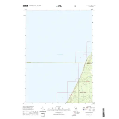
2019 Map of Manistee NW
USGS Topo · Published 2019About this map
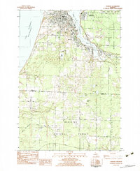
Lake Michigan dominates the western half of this coastal survey, where the waters meet the sandy shoreline of West Michigan. The landscape is defined by the heavy timber of the Manistee National Forest, which covers the majority of the land area. This terrain is carved by small drainage systems like Gurney Cr and Cooper Cr, which flow westward toward the lake. The road network within the forest is a mix of established routes like Munro Rd and Morton Rd, alongside more specialized paths such as the Windwood Forest Trl. The map also captures the political boundary between Manistee Co and Mason Co, illustrating how this administrative line bisects the wooded tracts and shoreline roads including W Fox Farm Rd.
Find a feature on this map
15 named features on this map. Tap any name to fly to it.
Don’t see what you’re looking for? This feature index may not catch every label — zoom into the map to look around manually.
Map Details
Editions of this 2019 Manistee NW Map
This is the sole edition of this map. No revisions or reprints were ever made.
Other maps of this area

1931 · Manistee SE
USGS Topo · 1:31,680

1931 · Manistee SW
USGS Topo · 1:31,680

1954 · Manitowoc
USGS Topo · 1:250,000

1956 · Bar Lake
USGS Topo · 1:62,500

1958 · Manitowoc
USGS Topo · 1:250,000

1958 · Manistee
USGS Topo · 1:62,500
1976 · Bar Lake SE
USGS Topo · 1:24,000
1982 · Hamlin Lake
USGS Topo · 1:25,000
1982 · Kings Corners
USGS Topo · 1:25,000
1982 · Manistee
USGS Topo · 1:25,000