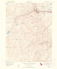
1950 Map of Manitou
USGS Topo · Published 1950About this map
Manitou and the western edge of Colorado Springs serve as the gateways to a landscape defined by extreme verticality and early tourism infrastructure. The map documents the intricate transportation networks required to navigate the Rampart Range, from the steep Inclined Railway to the winding course of the Manitou and Pikes Peak Ry. Higher elevations reveal small mountain enclaves like Ruxton Park, Minnehaha, and Artists Glen, connected by the Barr Trail as it ascends toward the peak beyond the western margin.
Find a feature on this map
92 named features on this map. Tap any name to fly to it.
Don’t see what you’re looking for? This feature index may not catch every label — zoom into the map to look around manually.
Map Details
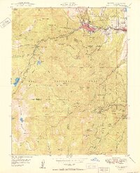
Editions of this 1950 Manitou Map
2 editions found
Other maps of this area

1893 · Colorado Springs
USGS Topo · 1:125,000

1894 · Pikes Peak
USGS Topo · 1:125,000

1901 · Pikes Peak
USGS Topo · 1:125,000

1901 · Pikes Peak
USGS Topo · 1:62,500

1909 · Colorado Springs
USGS Topo · 1:125,000

1942 · Colorado Springs
USGS Topo · 1:125,000

1948 · Mount Big Chief
USGS Topo · 1:24,000

1948 · Manitou Springs
USGS Topo · 1:24,000

1948 · Colorado Springs
USGS Topo · 1:62,500

1948 · Pikeview
USGS Topo · 1:24,000