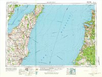
1954 Map of Manitowoc
USGS Topo · Published 1973About this map
Lake Michigan dominates the center of this mid-century survey, illustrating the maritime connections between Wisconsin's Door Peninsula and Michigan's western shore. Long before modern bridges, the map highlights the heavy industrial reliance on water transport, specifically the Ann Arbor Railway Car and Auto Ferry and the Chesapeake and Ohio Railway Car and Auto Ferry routes that bridged the two states. On the western shore, the shipbuilding and industrial centers of Manitowoc, Two Rivers, and Sturgeon Bay are prominent, while smaller fishing and agricultural hubs like Algoma and Kewaunee dot the coastline. To the east, the Michigan coastline is defined by the Manistee National Forest and the sandy reaches of Point Betsie and Sleeping Bear Point. The presence of the Chicago and North Western railroad line feeding into the lakeside ports emphasizes the era's integrated rail-to-ferry logistics system.
Find a feature on this map
76 named features on this map. Tap any name to fly to it.
Don’t see what you’re looking for? This feature index may not catch every label — zoom into the map to look around manually.
Map Details
Editions of this 1954 Manitowoc Map
2 editions found

Other maps of this area

1931 · Custer NW
USGS Topo · 1:31,680

1931 · Baldwin NW
USGS Topo · 1:31,680

1931 · Custer NE
USGS Topo · 1:31,680

1931 · Manistee SE
USGS Topo · 1:31,680

1931 · Freesoil SW
USGS Topo · 1:31,680

1931 · Manistee SW
USGS Topo · 1:31,680

1932 · Freesoil SE
USGS Topo · 1:31,680

1932 · Ludington NE
USGS Topo · 1:31,680

1932 · Ludington
USGS Topo · 1:31,680

1933 · Peacock SW
USGS Topo · 1:31,680