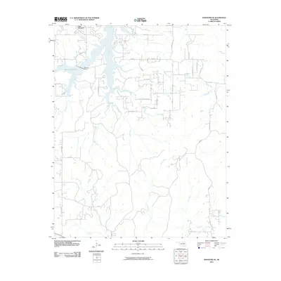
2010 Map of Mannford SE
USGS Topo · Published 2010About this map
New Mannford and the northern reaches of the Mannford Reservoir dominate this corner of Creek County, showing the intersection of modern settlement and hydraulic engineering. Controlled by the Mannford Dam, the reservoir pushes water into several prominent drainage systems including Salt Creek and Little Salt Creek. The terrain is defined by these meandering tributaries, with Fish Creek, Turkey Creek, and Tiger Creek carving south and east through the landscape toward Euchee Creek.
Find a feature on this map
39 named features on this map. Tap any name to fly to it.
Don’t see what you’re looking for? This feature index may not catch every label — zoom into the map to look around manually.
Map Details
Editions of this 2010 Mannford SE Map
This is the sole edition of this map. No revisions or reprints were ever made.
Other maps of this area

1901 · Nuyaka
USGS Topo · 1:125,000

1912 · Hominy
USGS Topo · 1:125,000

1914 · Kiefer
USGS Topo · 1:62,500

1915 · Hominy
USGS Topo · 1:125,000

1916 · Kiefer
USGS Topo · 1:62,500

1916 · Bristow
USGS Topo · 1:62,500

1954 · Oklahoma City
USGS Topo · 1:250,000

1955 · Enid
USGS Topo · 1:250,000

1957 · Oklahoma City
USGS Topo · 1:250,000

1958 · Enid
USGS Topo · 1:250,000