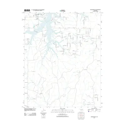
2012 Map of Mannford SE
USGS Topo · Published 2012About this map
New Mannford and its surrounding Creek County landscape are defined by the expansive waters of the Mannford Reservoir and the Mannford Water Supply Lake. This 2012 survey illustrates a region where residential development, seen in neighborhoods like Pelican Point Pl and along Lakeview Dr, meets a complex network of tributaries feeding into the Arkansas River basin. The geography is characterized by the convergence of multiple named waterways, including Little Salt Cr, Salt Cr, and Turkey Cr, which carve through the terrain south of the main reservoir. These drainage patterns, including Tiger Cr and Fish Cr to the east, shaped the local road grid, which consists primarily of numeric section-line roads such as W 31st St S and S 317th W Ave. The map provides a precise record of the shoreline and suburban footprint just as the area was seeing modern expansion.
Find a feature on this map
94 named features on this map. Tap any name to fly to it.
Don’t see what you’re looking for? This feature index may not catch every label — zoom into the map to look around manually.
Map Details
Editions of this 2012 Mannford SE Map
This is the sole edition of this map. No revisions or reprints were ever made.
Other maps of this area

1901 · Nuyaka
USGS Topo · 1:125,000

1912 · Hominy
USGS Topo · 1:125,000

1914 · Kiefer
USGS Topo · 1:62,500

1915 · Hominy
USGS Topo · 1:125,000

1916 · Kiefer
USGS Topo · 1:62,500

1916 · Bristow
USGS Topo · 1:62,500

1954 · Oklahoma City
USGS Topo · 1:250,000

1955 · Enid
USGS Topo · 1:250,000

1957 · Oklahoma City
USGS Topo · 1:250,000

1958 · Enid
USGS Topo · 1:250,000