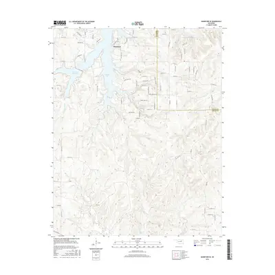
2016 Map of Mannford SE
USGS Topo · Published 2016About this map
Mannford sits at the northern edge of this landscape, positioned where the terrain meets the southern reaches of Keystone Lake. This area of Creek County is defined by its complex drainage network, where numerous waterways like Turkey Cr and Euchee Cr carve through the hills. The presence of the Mannford Reservoir and the northern tip of Heyburn Reservoir highlights the managed water systems that dominate the local topography. Further exploration of the map reveals the local road system, including Pea Ridge Dr and Blue Ridge Dr, which follow the contours of the land. These features illustrate the intersection of 21st-century residential expansion and the traditional creek-fed basins that have historically shaped the region south of the Keystone Lake shoreline.
Find a feature on this map
76 named features on this map. Tap any name to fly to it.
Don’t see what you’re looking for? This feature index may not catch every label — zoom into the map to look around manually.
Map Details
Editions of this 2016 Mannford SE Map
This is the sole edition of this map. No revisions or reprints were ever made.
Other maps of this area

1901 · Nuyaka
USGS Topo · 1:125,000

1912 · Hominy
USGS Topo · 1:125,000

1914 · Kiefer
USGS Topo · 1:62,500

1915 · Hominy
USGS Topo · 1:125,000

1916 · Kiefer
USGS Topo · 1:62,500

1916 · Bristow
USGS Topo · 1:62,500

1954 · Oklahoma City
USGS Topo · 1:250,000

1955 · Enid
USGS Topo · 1:250,000

1957 · Oklahoma City
USGS Topo · 1:250,000

1958 · Enid
USGS Topo · 1:250,000