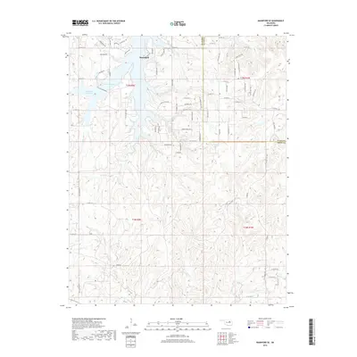
2018 Map of Mannford SE
USGS Topo · Published 2018About this map
The town of Mannford anchors the northern portion of this landscape, situated at the edge of the expansive Keystone Lake and Mannford Reservoir. The terrain is defined by the complex, branching inlets of the reservoir, where the waters meet the winding courses of Little Salt Cr and Salt Cr. To the south and east, the map reveals a rugged network of drainage systems including Turkey Cr, Tiger Cr, and Euchee Cr, which carve through the land across the Creek and Tulsa County line. Modern development is evident in the dense street naming on the hillsides, with local history reflected in road names such as Creek Nation Dr, Pea Ridge Rd, and Robert E Lee Trl, illustrating the intersection of suburban growth with the older geographical character of northeastern Oklahoma.
Find a feature on this map
77 named features on this map. Tap any name to fly to it.
Don’t see what you’re looking for? This feature index may not catch every label — zoom into the map to look around manually.
Map Details
Editions of this 2018 Mannford SE Map
This is the sole edition of this map. No revisions or reprints were ever made.
Other maps of this area

1901 · Nuyaka
USGS Topo · 1:125,000

1912 · Hominy
USGS Topo · 1:125,000

1914 · Kiefer
USGS Topo · 1:62,500

1915 · Hominy
USGS Topo · 1:125,000

1916 · Kiefer
USGS Topo · 1:62,500

1916 · Bristow
USGS Topo · 1:62,500

1954 · Oklahoma City
USGS Topo · 1:250,000

1955 · Enid
USGS Topo · 1:250,000

1957 · Oklahoma City
USGS Topo · 1:250,000

1958 · Enid
USGS Topo · 1:250,000