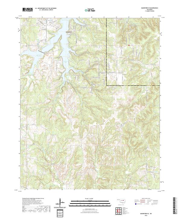
2022 Map of Mannford SE
USGS Topo · Published 2022About this map
Mannford and the sprawling waters of Keystone Lake dominate the northern reaches of this landscape along the border of Creek and Tulsa Counties. This modern topographic survey highlights a transition from the developing residential road networks near the lake, such as Lakeview Dr and Dogwood Rd, to the deeply incised drainage basins of the south. Numerous waterways, including Turkey Creek, Euchee Creek, and Fish Creek, carve through the terrain, illustrating the complex hydrological network that feeds into the Arkansas River system. The area's relief is defined by prominent elevations like Round Mountain and the high ground along Blue Ridge Dr, which provide a distinct contrast to the low-lying Mannford Reservoir. The grid of the Public Land Survey System, including t19n r9e, provides a clear framework for locating specific family tracts and property boundaries in this part of Oklahoma.
Find a feature on this map
83 named features on this map. Tap any name to fly to it.
Don’t see what you’re looking for? This feature index may not catch every label — zoom into the map to look around manually.
Map Details
Editions of this 2022 Mannford SE Map
This is the sole edition of this map. No revisions or reprints were ever made.
Other maps of this area

1901 · Nuyaka
USGS Topo · 1:125,000

1912 · Hominy
USGS Topo · 1:125,000

1914 · Kiefer
USGS Topo · 1:62,500

1915 · Hominy
USGS Topo · 1:125,000

1916 · Kiefer
USGS Topo · 1:62,500

1916 · Bristow
USGS Topo · 1:62,500

1954 · Oklahoma City
USGS Topo · 1:250,000

1955 · Enid
USGS Topo · 1:250,000

1957 · Oklahoma City
USGS Topo · 1:250,000

1958 · Enid
USGS Topo · 1:250,000