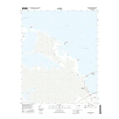
2016 Map of Manns Harbor
USGS Topo · Published 2016About this map
Manns Harbor and Mashoes anchor this coastal survey of the Dare County mainland, where the North Carolina sounds converge. The landscape is defined by the expansive Mashoes Marsh and the labyrinthine waterways of Spence Creek, Poster Gut, and Gar Gut. Connectivity to the Outer Banks is prominent through the William B Umstead Memorial Bridge and the Virginia Dare Memorial Brg, which span the waters of Croatan Sound. To the north, Durant Island and The Frying Pan mark the transition into the Albemarle Sound. The presence of Old Ferry Dock Rd reflects the area's maritime transportation history, while family-named landmarks like Caroon Point and Fleetwood Point provide specific points of interest for local genealogy and shoreline study.
Find a feature on this map
31 named features on this map. Tap any name to fly to it.
Don’t see what you’re looking for? This feature index may not catch every label — zoom into the map to look around manually.
Map Details
Editions of this 2016 Manns Harbor Map
This is the sole edition of this map. No revisions or reprints were ever made.
Other maps of this area

1940 · Kitty Hawk
USGS Topo · 1:62,500

1940 · Powells Point
USGS Topo · 1:62,500

1943 · Roanoke Island
USGS Topo · 1:125,000

1946 · Eastville
USGS Topo · 1:250,000

1946 · Currituck Sound
USGS Topo · 1:250,000

1953 · Wanchese
USGS Topo · 1:24,000

1953 · Buffalo City
USGS Topo · 1:24,000

1953 · Manteo
USGS Topo · 1:24,000

1953 · East Lake SE
USGS Topo · 1:24,000

1953 · Manns Harbor
USGS Topo · 1:24,000